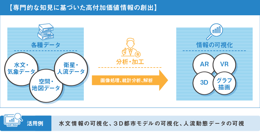
現実世界の多様な情報をデジタル空間で表現し、人間が直接「見る」ことのできない現象・事象・時空間関連性をより高度でかつリアリティーに可視化します。
気象・水文データ、点群データ、空中写真、衛星画像、人流動態データなどあらゆる内容・形式のデータについて、目的に応じた変換処理、モデリング、可視化を行うサービスやシステム構築を実施します。
We represent a variety of information from the real world in digital space, and visualize phenomena, events, and spatio-temporal relationships that cannot be directly "seen" by humans in a more sophisticated and realistic way.
We build services and systems that perform conversion processing, modeling, and visualization of all types of data, including meteorological and hydrological data, point cloud data, aerial photographs, satellite images, and human dynamics data, according to the purpose.
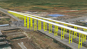
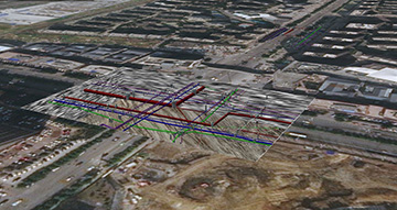
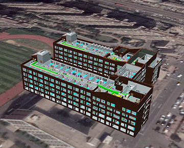
地理空間上に3D都市モデルを可視化するWebGISシステムを構築します。
単なる外観の可視化にとどまらず、地物の種別や属性などの情報を含めて各種統計分析や解析シミュレーションにも適用でき、情報共有や意思決定支援の情報基盤に拡張可能です。
This is a WebGIS system for visualizing 3D city models in geographic space.
The system can be applied to not only visualize the appearance of a city, but also to various statistical analyses and analytical simulations, including information on the type and attributes of land, and can be extended to an information base for information sharing and decision support.
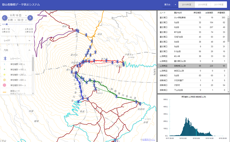
ビーコンで取得した人流の時系列データについて、人流動態の時空間的な分布状況を地図および図表に可視化するシステムを構築することができます。
It is possible to build a system to visualize the spatio-temporal distribution of human flow dynamics on maps and charts of time-series data of human flow acquired with beacons.
本システムは「文部科学省次世代火山研究推進事業」の予算より開発した This system was developed with the budget of "Next Generation Volcano Research Promotion Project of the Ministry of Education, Culture, Sports, Science and Technology-Japan"
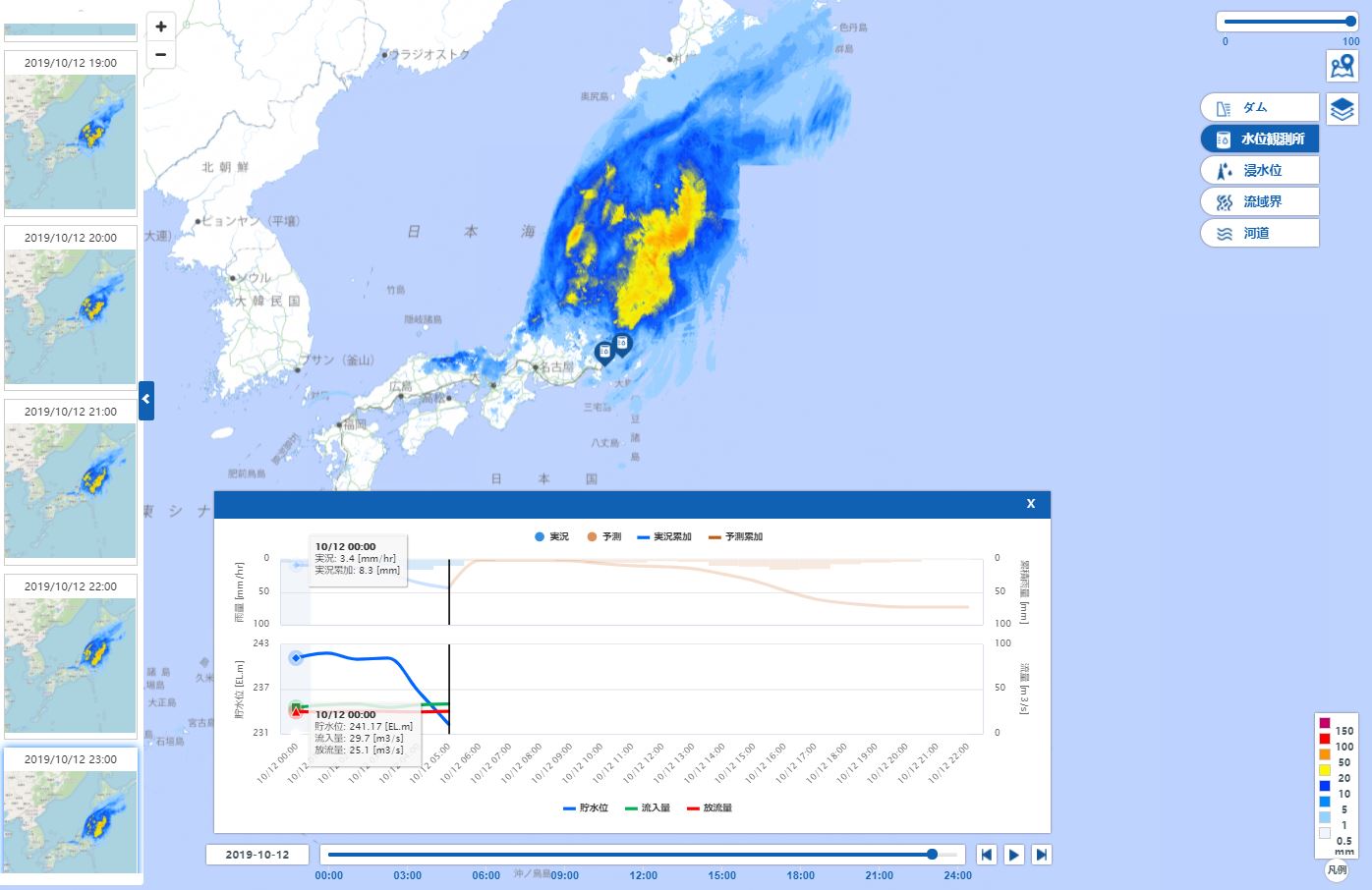
気象庁が配信する解析雨量・予測雨量データや、水位観測所の水位・流量、ダム事務所のダム流入・放流量や貯水位といった水文情報の可視化システムを構築します。
最新のWebGIS技術により全国範囲のレーダ雨量分布のアニメーションや任意地点の雨量値表示、雨量分布図とハイドログラフの連動表示など高度な機能を備えて、災害時やダム利用の意思決定に役立ちます。
A visualization system for hydrological information, such as analytical rainfall and forecasted rainfall data distributed by the Japan Meteorological Agency, water levels and flows at water level monitoring stations, dam inflow and discharge volumes, and water storage levels at dam offices, will be constructed.
The system is equipped with advanced functions, such as animations of radar rainfall distributions throughout the country, display of rainfall values at arbitrary points, and display of rainfall distribution maps and hydrographs in conjunction with each other using the latest WebGIS technology, and is useful for decision-making during disasters and dam use.