
最新のWeb可視化技術を活用し、ユーザに斬新な操作性と視認性を提供するWebGISシステムの開発を行います。
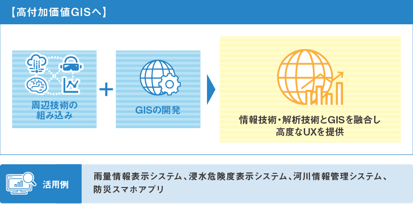
人流動態、気象水文などの時空間データについて、地図とグラフの連動により任意の場所・時刻の情報に瞬時にアクセスすることができます。また、高度なGIS空間解析やデータサイエンスの技術により高付加価値情報の生成・提供が可能です。
3D都市モデル、BIM/CIMモデルのWeb可視化を取り込んでいます。
We develop a WebGIS system that provides users with innovative operability and visibility by utilizing the latest web visualization technology.
The system allows users to instantly access spatio-temporal data, such as human flow dynamics and meteorological hydrology, at any location and time by linking maps and graphs. We can also generate and provide high value-added information through advanced GIS spatial analysis and data science technologies.
Web visualization of 3D city models and BIM/CIM models are incorporated.
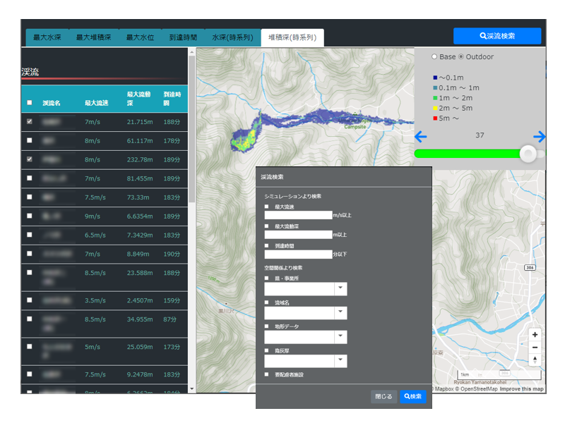
土石流氾濫シミュレーションシステムの事例 Example of a mudflow inundation simulation system
DotSpatial、MapWinGIS、GDALなどオープンソース(OSS)のGISライブラリを用いて、必要な機能だけを自由に配布することが可能なGISアプリケーションの開発を行います。
ArcGISやQGISのアドインやスクリプト形式のカスタマイズ開発にも対応可能です。
Using open source (OSS) GIS libraries such as DotSpatial, MapWinGIS and GDAL, we develop GIS applications that can be freely distributed with only the necessary functions.
We can also support customized development of ArcGIS and QGIS add-ins and script formats.
GISアプリケーションの開発例 Examples of GIS application development
各種GISデータの地理空間やトポロジ構造の関係を利用した空間分析、ネットワーク解析、水理解析などを実施します。
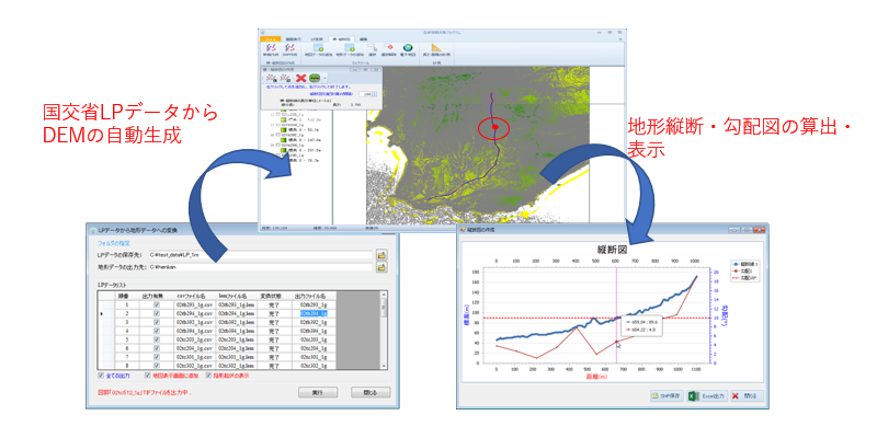
点群データや空中写真、衛星画像などとGISデータの変換・分析の実施またはアプリケーションの開発を行います。
Perform spatial analysis, network analysis, and hydraulic analysis using geospatial and topological structure relationships of various GIS data.
We perform conversion and analysis of GIS data to point cloud data, aerial photographs, satellite images, etc. or develop applications.