
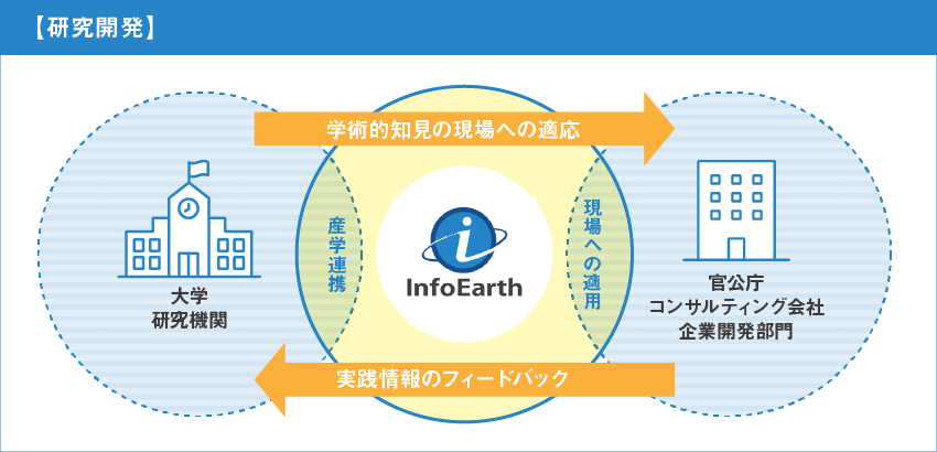
日進月歩で発展している先進的な技術をいち早く社会課題の解決に適用させるため、最新の技術をスピーディーにキャッチアップする強みと、土木工学や情報工学の知見を生かして、大学などの研究機関とも連携しながら、以下のような研究開発を積極的に行っています。
In order to apply rapidly developing advanced technologies to solve social problems as quickly as possible, we are actively engaged in the following research and development in collaboration with universities and other research institutions, taking advantage of our strength in quickly catching up on the latest technologies and our knowledge of civil engineering and information technology.
洪水で河川の破堤・越流の危険性が高い場所が特定された際に、氾濫水がいつ、どこまで到達するのかを予測するために、物理モデルによる浸水シミュレーションの結果を真値(教師データ)として、氾濫流量から6時間先までの浸水深分布の時系列変化を予測するAIモデルを開発した。
In order to predict when and how far flood waters will reach a river at high risk of breaching or overflowing, an AI model has been developed that uses the results of physical model inundation simulations as true data (teacher data) to predict changes in the distribution of inundation depth from the flood flow rate to six hours ahead.
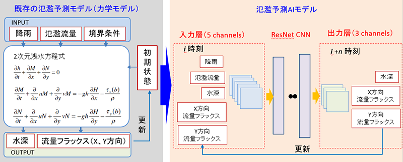
AIモデルの概要 Overview of the AI Model
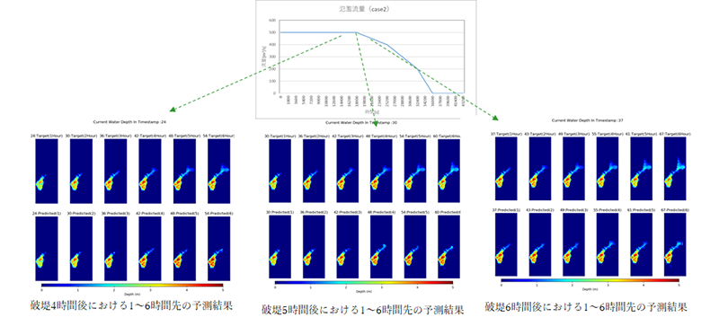
検証計算例(上段:真値、下段:AI予測結果) Example of verification calculation (upper row: true value, lower row: AI prediction result)
流域の積雪深・積雪密度の空間分布を推定し、任意区域の積雪包蔵水量や融雪水量・融雪速度の時系列変化を推定できるAIモデルを開発した。
本モデルの開発は、内閣府による2019年度課題解決に向けた先進的な衛星リモートセンシングデータ利用モデル実証プロジェク※において採択されて実施し、さらに衛星データの取得から利用者への情報提供まで行えるシステムの構成を検討し、生産性向上や災害対応等利用ニーズの検討を行った。
We have developed an AI model that can estimate the spatial distribution of snow depth and density in a watershed, and can estimate time series changes in the amount of water contained in snow and snowmelt water and snowmelt speed in a given area.
The development of this model was adopted as part of the Advanced Satellite Remote Sensing Data Application Model Demonstration Project* by the Cabinet Office for solving issues in fiscal 2019, and the configuration of the system, which can acquire satellite data and provide information to users, was studied to determine the needs for use in improving productivity and responding to disasters.
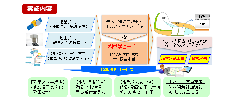
実証実験内容 Details of the demonstration experiment
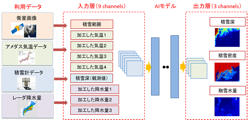
AIモデルの概要 Overview of the AI Model
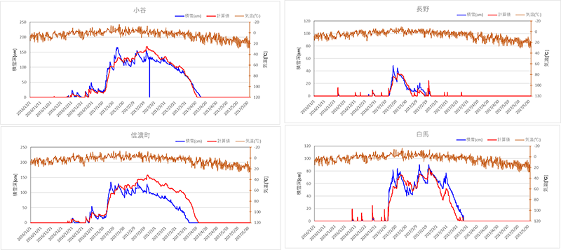
物理モデルによる積雪深の計算精度の検証(青:アメダス、赤:計算結果) Verification of the accuracy of the calculation of snow depth by a physical model (blue: Amedas, red: calculation results)
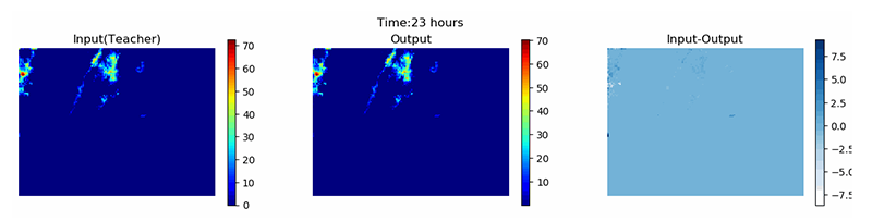
AIによる積雪深分布の推定精度の検証(左:真値、中:AIによる結果、右:誤差) Verification of the accuracy of snow depth estimation by AI (left: true value, middle: AI results, right: error)